NASA is using open science to explore Mars like never before. By sharing data from spacecraft, rovers, and orbiters, NASA allows scientists and the public to study the Red Planet in detail. Open science accelerates discoveries, supports collaboration, and helps researchers create accurate maps of Mars’ surface, geology, and potential landing sites for future missions.
Here’s how open science is shaping our understanding of Mars.
What Is Open Science?
Open science means making research data, tools, and results freely available to everyone. For Mars exploration, this includes:
- High-resolution images of the surface
- Topographic and elevation maps
- Mineral and chemical composition data
- Rover and lander measurements
By providing open access, NASA enables scientists worldwide to analyze the data, test hypotheses, and make new discoveries.
NASA Missions That Support Open Science
Several NASA missions have contributed to the Red Planet data archive:
- Mars Reconnaissance Orbiter (MRO): Captures detailed images and maps of Mars’ surface
- Curiosity Rover: Explores Gale Crater, analyzing rocks and soil
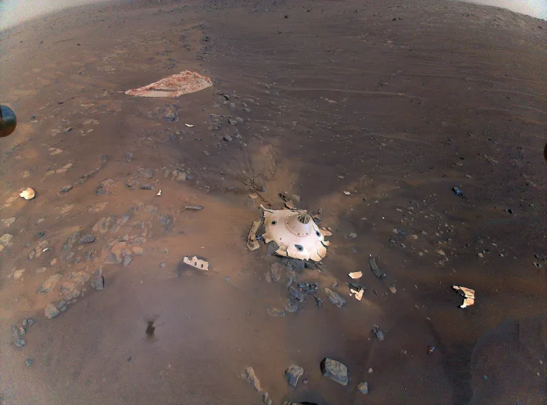
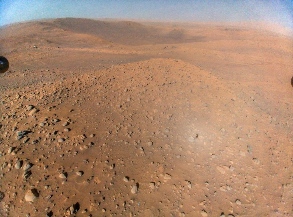
- Perseverance Rover: Studies Jezero Crater and collects samples for future return to Earth
- InSight Lander: Measures Mars’ interior, including seismic activity
All mission data is shared openly through NASA’s Planetary Data System (PDS), enabling global access.
Mapping Mars in Detail
Mapping Mars is critical for understanding the planet’s history, geology, and potential for life. Open science supports mapping by:
- Combining satellite imagery with rover data for accurate surface maps
- Identifying mineral deposits, ice, and ancient riverbeds
- Locating safe landing sites for future human missions
- Detecting geological hazards, like cliffs, sand dunes, and craters
Researchers can overlay different datasets to see the Red Planet in ways not possible during the missions’ initial analysis.
Mapping the Red Planet with the Power of Open Science
Tools and Platforms for Open Mars Data
NASA provides several platforms for accessing Mars data:
- Planetary Data System (PDS): Central repository for planetary mission data
- Mars Trek: Interactive mapping tool to explore the surface of Mars in 3D
- HiRISE Image Catalog: High-resolution images from the Mars Reconnaissance Orbiter
- NASA Open Data Portal: Access to mission datasets, including images, maps, and scientific measurements
These tools allow scientists, educators, and enthusiasts to study Mars and even contribute to research projects.
Collaboration Across the Globe
Open science fosters international collaboration:
- Scientists from different countries can access the same datasets
- Universities and research institutions use the data for studies, simulations, and modeling
- Collaborative projects improve understanding of Martian geology, climate, and potential resources
This approach speeds up discoveries and allows for cross-disciplinary insights.
Citizen Science and Public Engagement
NASA also invites the public to participate in Mars research:
- Projects like Mars Mappers let volunteers help classify surface features
- Educational programs use open data for student projects and competitions
- Crowdsourcing allows the public to spot patterns, craters, or unusual geological formations
Public involvement increases awareness and inspires the next generation of planetary scientists.
How Open Science Accelerates Discovery
By sharing data freely, open science allows:
- Faster analysis using modern tools and AI
- Re-examination of old datasets with new techniques
- Combining datasets from multiple missions for comprehensive studies
- Discovery of new geological features, mineral deposits, and evidence of past water
NASA ensures that the knowledge gained from missions continues to grow long after spacecraft launch.
Preparing for Future Mars Missions
Mapping Mars with open science is critical for:
- Identifying safe landing zones for astronauts
- Planning rover and drone exploration routes
- Understanding potential resources like water ice and minerals
- Supporting long-term human settlement plans on Mars
Open science data provides a foundation for informed planning and reduces risks for future exploration.
Success Stories from Open Mars Data
Some notable discoveries enabled by open Mars data include:
- Identification of ancient riverbeds and lakebeds suggesting past water activity
- Detection of seasonal methane fluctuations that may indicate geological or biological activity
- Detailed maps of Martian terrain helping select sites for Perseverance rover exploration
- Publicly contributed observations leading to better classification of surface features
These examples show how open science can unlock new knowledge even years after data collection.
The Future of Mars Exploration with Open Science
NASA continues to expand access and usability of Mars data:
- Integrating AI and machine learning to analyze large datasets
- Enhancing visualization tools to make maps more detailed and interactive
- Supporting global partnerships for collaborative research
- Encouraging citizen science and educational use of Mars datasets
The goal is to make Mars exploration inclusive, efficient, and driven by both professionals and the public.
Conclusion
Open science is transforming how we study Mars. By sharing images, maps, and measurements, NASA allows scientists, students, and volunteers worldwide to explore the Red Planet. This collaborative approach accelerates discoveries, improves mapping accuracy, and prepares humanity for future missions.
With open data, we are not just observing Mars—we are engaging the world in understanding it, one map, one measurement, and one discovery at a time.
Read Also: Keep your face towards the sunshine and shadows will fall behind you
Watch Also: https://www.youtube.com/@TravelsofTheWorld24


Leave a Reply