NASA’s exploration of Mars has yielded a treasure trove of images, revealing the Red Planet in unprecedented detail. From towering dust storms to intricate rock formations, these photographs provide both scientists and the public with a stunning window into Mars’ geology, climate, and potential for past life. Over the past two decades, NASA’s fleet of orbiters, rovers, and landers has captured thousands of images, each telling a unique story about Mars’ dynamic environment.
This article highlights 11 eye-opening images from NASA’s Mars missions, showcasing the planet’s beauty, scientific intrigue, and the ongoing search for clues about its past.
1. The First Close-Up of Mars’ Surface
NASA’s Mars Global Surveyor (MGS), launched in 1996, delivered one of the first high-resolution images of the Martian surface. The photo revealed:
-
Ancient riverbeds
-
Cratered plains
-
Sedimentary layers
This image transformed our understanding of Mars, providing the first concrete evidence that water may have once flowed across the planet’s surface.
2. Olympus Mons: The Largest Volcano in the Solar System
Captured by Mars Odyssey and other orbiters, Olympus Mons dominates Mars’ horizon. Highlights include:
-
Height: 22 km, nearly three times Mount Everest
-
Base width: 600 km
-
Evidence of past volcanic activity
The image illustrates Mars’ geologic power and hints at a planet that was once volcanically active, shaping its surface over billions of years.
3. The Valles Marineris Canyon System
The Valles Marineris, a canyon system over 4,000 km long, was captured in dramatic detail by the Mars Reconnaissance Orbiter (MRO). The image shows:
-
Deep chasms
-
Layered rock formations
-
Possible ancient water flow
This canyon system is comparable to Earth’s Grand Canyon but on a much larger scale, suggesting tectonic activity and erosion processes on Mars.
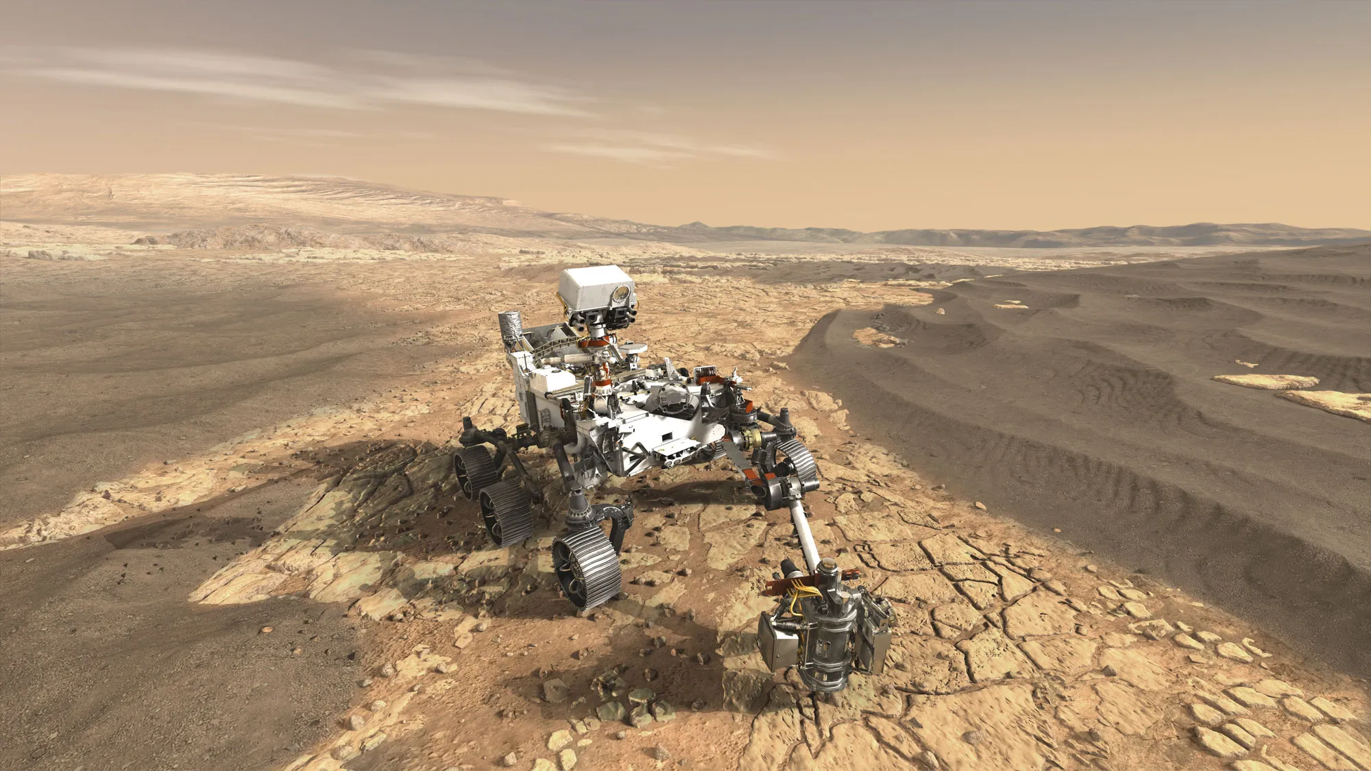
4. Curiosity Rover’s Self-Portrait
NASA’s Curiosity rover captured an iconic self-portrait at the Gale Crater. Highlights of the image:
-
Curiosity’s robotic arm and wheels in detail
-
Martian terrain in the background
-
Dust and soil composition visible
This image provides a sense of scale and allows scientists to monitor rover health while inspiring the public.
5. Martian Dust Storms in Action
One of the most dramatic images comes from Mars Global Surveyor, showing massive dust storms engulfing large portions of the planet. Observations from this image include:
-
Storms can cover entire hemispheres
-
Dust storms influence temperature and weather patterns
-
Important for future human exploration
These visuals illustrate the challenges of Martian weather and the need for careful planning for robotic and crewed missions.
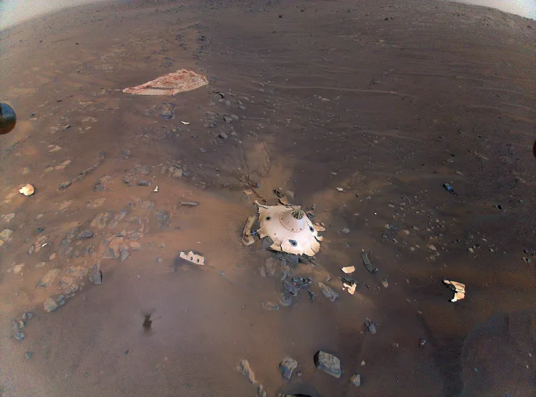
6. Perseverance Rover Landing Site
The Perseverance rover, part of NASA’s Mars 2020 mission, captured high-resolution images of Jezero Crater, its landing site. Notable features:
-
Ancient river delta
-
Sedimentary rock layers
-
Signs of past water activity
These images help scientists identify potential sites for searching signs of ancient microbial life.
7. Close-Up of Martian Rock Layers
Curiosity and Perseverance have provided close-up images of Martian rock strata, revealing:
-
Sandstone and mudstone formations
-
Evidence of sedimentary deposition
-
Chemical composition indicating past water flow
These images allow researchers to reconstruct Mars’ geological and climatic history.
8. The First Image of a Martian Dust Devil
NASA rovers captured the first image of a dust devil on Mars, a small whirlwind of swirling dust and debris. Key observations:
-
Diameter of several meters
-
Movement across plains
-
Influence on dust distribution and surface conditions
This image shows that Mars is still a dynamic planet, shaped by wind-driven processes.
9. Ingenuity Helicopter’s Aerial View
The Ingenuity helicopter, a technological first, provided aerial images of Mars. Features include:
-
Elevated perspectives of craters and dunes
-
Mapping terrain inaccessible to rovers
-
Capturing shadowed regions and ridges
Ingenuity’s flights mark a new era of Martian exploration, combining aerial reconnaissance with rover missions.
10. Signs of Ancient Lakes
NASA images from orbiters revealed ancient lakebeds, particularly in Gale Crater. Observations include:
-
Layered sedimentary deposits
-
Channels suggesting inflow and outflow
-
Potential habitability conditions
These images are critical in the ongoing search for life on Mars, offering evidence that water was once abundant.
11. The Mars Horizon at Sunset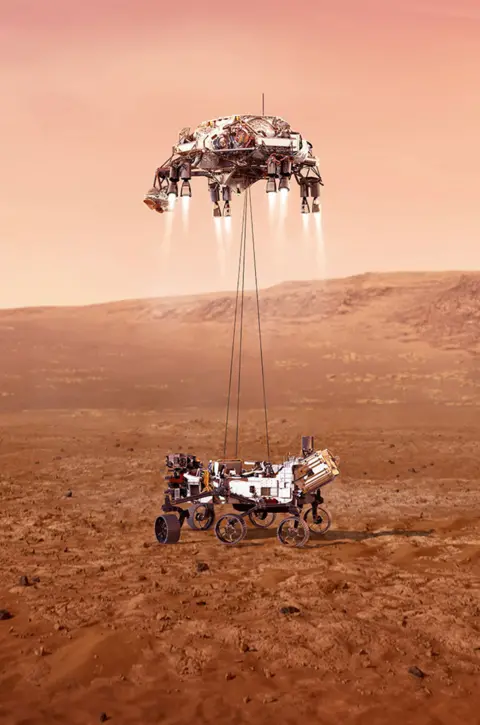
One of the most visually striking images comes from Curiosity, capturing a Martian sunset. Highlights include:
-
Blue-tinted atmospheric glow due to fine dust
-
Distinct horizon shapes
-
Demonstrates atmospheric scattering on Mars
This image provides a humanizing glimpse of Mars, reminding us of the planet’s stark beauty and alien landscapes.
Scientific Significance of the Images
NASA’s Mars images are more than just beautiful—they are vital to science. They help researchers:
-
Understand Mars’ geological history
-
Study past water activity
-
Map future landing sites
-
Monitor dust storms and weather patterns
-
Search for signs of past microbial life
Each image contributes to a growing database that supports robotic exploration, future human missions, and climate comparisons with Earth.
Technological Advancements in Imaging
Capturing these images required innovative technology:
-
High-resolution cameras on orbiters and rovers
-
Panoramic cameras for wide-field views
-
Mast cameras (Mastcam) on rovers for detailed geological study
-
Helicopter-based cameras for aerial mapping
-
Advanced image-processing software to enhance clarity
These technologies allow NASA to produce scientifically accurate and visually stunning representations of Mars.
Inspiration and Public Engagement
NASA’s Mars images inspire not only scientists but also the global public. They:
-
Capture imagination and curiosity
-
Encourage students to study STEM fields
-
Provide a realistic view of potential human exploration
-
Highlight Earth’s uniqueness through planetary comparison
NASA regularly releases these images, often accompanied by detailed explanations and 3D visualizations to maximize public engagement.
Future Mars Imaging Missions
NASA is planning new imaging campaigns:
-
Mars Ice Mapper to map subsurface ice
-
Next-generation orbiters with higher-resolution cameras
-
Advanced rover instruments to study mineralogy and chemistry
-
Integration with commercial satellite imagery for collaborative research
These missions will expand our understanding of Mars and provide a foundation for future human exploration.
Conclusion
NASA’s collection of Mars images offers an extraordinary window into a planet that is both alien and familiar. From dust storms to ancient lakebeds, from the towering Olympus Mons to the delicate blue sunsets, these images reveal the dynamic, evolving nature of Mars. Each photograph serves as both a scientific resource and an inspiration, reminding humanity of the wonders that lie beyond our home planet.
As NASA continues its robotic exploration, aerial reconnaissance, and orbital mapping, we can expect even more eye-opening images in the coming years, bringing Mars closer to Earth than ever before.
Read Also: Keep your face towards the sunshine and shadows will fall behind you
Watch Also: https://www.youtube.com/@TravelsofTheWorld24


Leave a Reply