For decades, NASA has captured breathtaking images of Earth from space, offering humanity a perspective that is both awe-inspiring and humbling. These photographs not only showcase the beauty of our planet but also help scientists monitor environmental changes, track natural disasters, and study climate patterns. From the swirling clouds over the Pacific Ocean to the glittering city lights at night, NASA’s images reveal Earth in ways we could never imagine from the ground.
This article highlights some of the best NASA images of Earth from space, explaining the science behind them and why they matter.
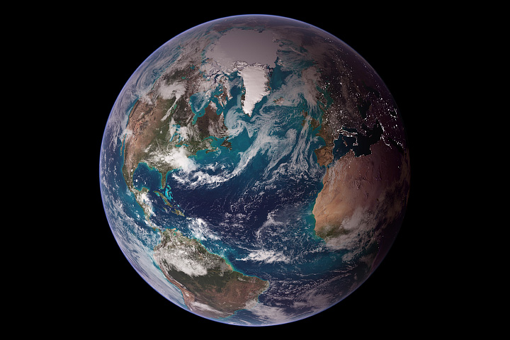
1. The Blue Marble – Classic View of Earth
One of the most iconic images ever captured is the “Blue Marble”, taken in 1972 by the Apollo 17 crew. This photograph shows Earth as a bright, beautiful sphere floating in the blackness of space. The image emphasizes:
-
The vast oceans that cover over 70% of Earth’s surface
-
The delicate atmosphere surrounding the planet
-
The interconnectedness of land, sea, and sky
The Blue Marble remains a symbol of environmental awareness and global unity, inspiring generations to appreciate the planet’s fragility.
2. Earth at Night – City Lights from Space
NASA’s Earth at Night images reveal the planet in a whole new light—literally. Satellites capture the glow of cities, highways, and urban centers across continents. These photographs are important because they:
-
Show patterns of human settlement and development
-
Help scientists track population density
-
Provide insights into energy consumption and light pollution
The contrast between dark natural areas and illuminated urban centers offers a unique perspective on human activity from orbit.
3. Dynamic Weather Patterns
NASA satellites frequently capture weather phenomena such as hurricanes, cyclones, and massive storms. Stunning images like Hurricane Florence or Typhoon Haiyan show:
-
Spiral bands of clouds
-
Eye structures of hurricanes
-
Movement and intensity of storms
These images are crucial for meteorologists, helping to forecast storms, understand atmospheric dynamics, and prepare for natural disasters.
4. The Northern and Southern Lights
Auroras are among Earth’s most spectacular natural phenomena, and NASA’s space-based imagery captures them from above. When charged particles from the sun interact with Earth’s magnetic field, they create vivid curtains of light. NASA images show:
-
Green, red, and purple auroral displays
-
Polar regions illuminated in patterns invisible from the ground
-
Dynamic, ever-changing aurora structures
These images highlight the delicate balance of Earth’s magnetic field and atmosphere.
5. Earth’s Climate and Environmental Changes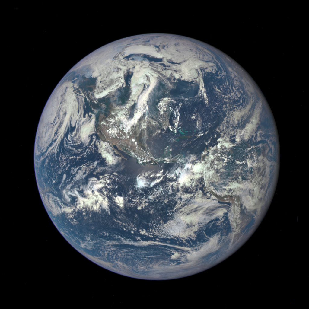
NASA’s Earth-observing satellites like Terra, Aqua, and Landsat provide images that track climate and environmental changes over time. Examples include:
-
Melting polar ice caps
-
Deforestation in the Amazon rainforest
-
Expanding desert regions
-
Coral reef bleaching events
These images serve as a visual record of human impact on the environment and guide policymakers in conservation efforts.
6. Volcanic Eruptions and Geological Activity
From space, volcanic eruptions, lava flows, and seismic activity become strikingly visible. NASA images document:
-
Erupting volcanoes in Hawaii and Iceland
-
Lava reaching the ocean and creating new landforms
-
Ash plumes spreading across continents
Such imagery aids geologists in studying Earth’s geological processes and potential hazards.
7. Ocean Currents and Natural Formations
The swirling blues, greens, and browns in NASA’s satellite photos highlight ocean currents, river deltas, and coral formations. These images help scientists:
-
Monitor ocean health and pollution
-
Track phytoplankton blooms, which are critical for carbon absorption
-
Understand sediment transport and coastal erosion
The stunning colors also showcase the beauty of Earth’s aquatic ecosystems from orbit.
8. Extreme Natural Events
NASA has captured images of wildfires, floods, and droughts from space. Satellite imagery allows researchers to:
-
Assess the scale and impact of disasters
-
Track smoke plumes, floodwater coverage, and affected areas
-
Support emergency response and disaster management
These images provide crucial information for humanitarian aid and disaster preparedness.
9. Seasonal Changes and Snow Cover
NASA satellites record seasonal variations, capturing the transformation of landscapes throughout the year. Key observations include:
-
Snow-covered mountains and plains
-
Changes in vegetation patterns
-
Ice cover fluctuation in polar regions
These images help climatologists and ecologists understand seasonal cycles and long-term trends in ecosystems.
10. The Earth-Moon Perspective
Some of NASA’s most captivating images show Earth alongside the Moon, captured during lunar missions or from orbiting satellites. These shots remind us:
-
Of our planet’s smallness in the vast universe
-
How life depends on Earth’s unique conditions
-
Of the cosmic connection between celestial bodies
Such images inspire curiosity about space while emphasizing Earth’s fragility.
Why NASA Images Matter
NASA images are more than just visually stunning—they serve critical scientific, educational, and cultural purposes:
-
Science: Track climate change, monitor natural disasters, study Earth systems
-
Education: Teach students about geography, meteorology, and space science
-
Awareness: Inspire environmental stewardship and global responsibility
-
Exploration: Provide a foundation for planning future space missions and Earth observation strategies
By combining technology with creativity, NASA offers humanity a unique lens through which to view and understand our planet.
How These Images Are Captured
NASA uses a variety of tools to capture these images:
-
Satellites: Landsat, Terra, Aqua, Suomi NPP
-
Spacecraft: Apollo missions, ISS cameras
-
Remote Sensors: Multispectral and hyperspectral imaging to detect heat, light, and atmospheric data
Advanced imaging technologies ensure accuracy while providing stunning visuals that can be appreciated both scientifically and aesthetically.
Conclusion
From the iconic Blue Marble to dynamic storm systems, auroras, and human-made city lights, NASA’s images of Earth from space remind us of our planet’s beauty, complexity, and vulnerability. These photographs serve as both scientific tools and sources of inspiration, connecting people to Earth in ways unimaginable just decades ago.
Whether for education, research, or pure awe, NASA’s Earth imagery allows us to see the planet as a whole system, understand its challenges, and appreciate its wonders. Each image tells a story of our home in the cosmos, highlighting the need to protect and cherish it for generations to come.
Read Also: Keep your face towards the sunshine and shadows will fall behind you
Watch Also: https://www.youtube.com/@TravelsofTheWorld24


Leave a Reply